🚚 Estimate driving time and distance for logistics with Open Route API

DISCOUNT 20%

Tags: Supply Chain, Logistics, Route Planning, Transportation, GPS API
Context
Hi! I’m Samir, a Supply Chain Engineer and Data Scientist based in Paris, and founder of LogiGreen Consulting.
I help companies improve their logistics operations using data, AI, and automation to reduce costs and minimize environmental footprint.
> Let’s use n8n to build smarter and greener transport operations!
📬 For business inquiries, you can add find me on LinkedIn
Who is this template for?
This workflow is designed for logistics and transport teams who want to automate distance and travel time calculations for truck shipments.
Ideal for:
- Control tower dashboards
- Transport cost simulations
- Route optimisation studies
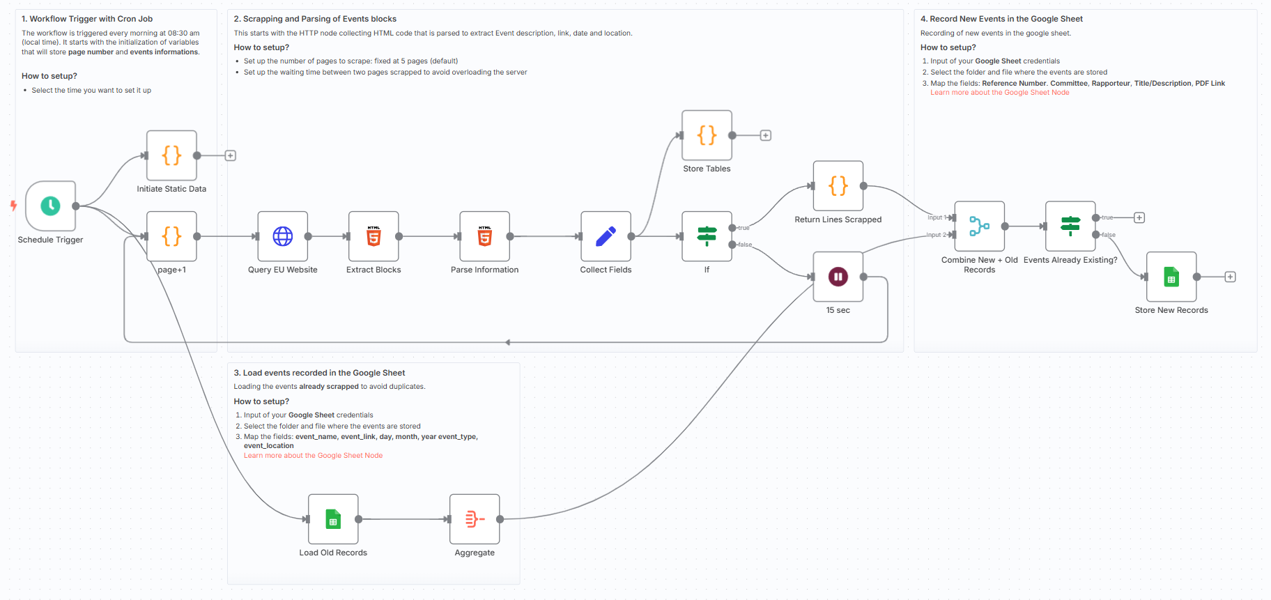
How does it work?
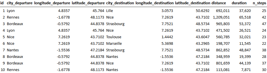
This n8n workflow connects to a Google Sheet where you store city-to-city shipment lanes, and uses the OpenRouteService API to calculate:
- 📏 Distance (in meters)
- ⏱️ Travel time (in seconds)
- 🪪 Number of route steps
Steps:
- ✅ Load departure/destination city coordinates from a Google Sheet
- 🔁 Loop through each record
- 🚚 Query OpenRouteService using the truck (driving-hgv) profile
- 🧾 Extract and store results: distance, duration, number of steps
- 📤 Update the Google Sheet with new values
What do I need to get started?
This workflow is beginner-friendly and requires:
- A Google Sheet with route pairs (departure and destination coordinates)
- A free OpenRouteService API key
👉 Get one here
Next Steps
🗒️ Follow the sticky notes inside the workflow to:
- Select your sheet
- Plug in your API key
- Launch the flow!

🚀 You can customize the workflow to:
- Add CO2 emission estimates for Sustainability Reporting
- Connect to your TMS via API or EDI
This template was built using n8n v1.93.0
Submitted: June 1, 2025